Map - Bicaz (Oraş Bicaz)

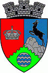
Bicaz (Oraş Bicaz)
Bicaz (Békás) is a town in Neamț County, Western Moldavia, Romania situated in the eastern Carpathian Mountains near the confluence of the Bicaz and Bistrița Rivers and near Lake Bicaz, an artificial lake formed by the Bicaz Dam on the Bistrița. Bicaz used to be a border town until 1918. Six villages are administered by the town: Capșa, Dodeni, Izvoru Alb, Izvoru Muntelui, Potoci and Secu.

Before the construction of the dam (1950–1960) the settlement was just a mountain village in Eastern Carpathians where the main economic activity was timber harvesting. By tradition, the tree trunks were linked together, forming a raft (pluta); a raftman (plutaș) used to drive the raft on the Bistrița river downstream to wood processing facilities in Piatra Neamț.

Building the dam created also a horizontal industry: two cement and aggregate plants were built in Bicaz proper and nearby Tașca. This, together with the construction of the Bicaz-Stejaru Hydroelectric Power Station (10 km to the east) triggered a relative economic boom during the communist period.

The Bicaz cement plant was shut down after the Romanian Revolution of 1989 and is slowly being taken apart. On the other hand, the Tașca cement plant was acquired by the German group HeidelbergCement and was completely overhauled. The town has also a few timber factories and wood processing facilities.

 
Map - Bicaz (Oraş Bicaz)
Map
Google - Map - Bicaz
Google
Google Earth - Map - Bicaz
Google Earth
Nokia - Map - Bicaz
Nokia
Openstreetmap - Map - Bicaz
Openstreetmap
Map - Bicaz - Esri.WorldImagery
Esri.WorldImagery
Map - Bicaz - Esri.WorldStreetMap
Esri.WorldStreetMap
Map - Bicaz - OpenStreetMap.Mapnik
OpenStreetMap.Mapnik
Map - Bicaz - OpenStreetMap.HOT
OpenStreetMap.HOT
Map - Bicaz - OpenTopoMap
OpenTopoMap
Map - Bicaz - CartoDB.Positron
CartoDB.Positron
Map - Bicaz - CartoDB.Voyager
CartoDB.Voyager
Map - Bicaz - OpenMapSurfer.Roads
OpenMapSurfer.Roads
Map - Bicaz - Esri.WorldTopoMap
Esri.WorldTopoMap
Map - Bicaz - Stamen.TonerLite
Stamen.TonerLite
Country - Romania
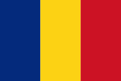
Flag of Romania
Romania (România ) is a country located at the crossroads of Central, Eastern, and Southeastern Europe. It borders Bulgaria to the south, Ukraine to the north, Hungary to the west, Serbia to the southwest, Moldova to the east, and the Black Sea to the southeast. It has a predominantly temperate-continental climate, and an area of 238397 km2, with a population of around 19 million. Romania is the twelfth-largest country in Europe and the sixth-most populous member state of the European Union. Its capital and largest city is Bucharest, followed by Iași, Cluj-Napoca, Timișoara, Constanța, Craiova, Brașov, and Galați. It is member of the European Union (EU), NATO, European Council, BSEC, and WTO.

Europe's second-longest river, the Danube, rises in Germany's Black Forest and flows southeasterly for 2857 km, before emptying into Romania's Danube Delta. The Carpathian Mountains cross Romania from the north to the southwest and include Moldoveanu Peak, at an altitude of 2544 m.
Currency / Language  
ISO Currency Symbol Significant figures
RON Romanian leu lei 2
Neighbourhood - Country  
  •  Bulgaria 
  •  Hungary 
  •  Moldova 
  •  Serbia 
  •  Ukraine 
Administrative Subdivision
City, Village,...